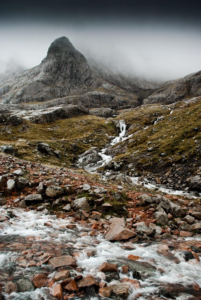
On a walk in the Highlands you may suddenly find yourself wrapped in a thin mist that then vanishes just as quickly. And that is exactly when, almost out of nowhere, an ink-dark loch may appear, surrounded by a sea of heather, rock and a wind that wraps around everything. Scotland’s mountains are not as high as the Alps, and they have no eternal glaciers or cable cars everywhere to carry tourists to the top. Yet they are ancient — older than almost any other range in Europe — and they hold a memory thousands of years old carved into the stone.
In this article we will explore them starting from geology and legends, then move on to the peaks worth knowing, the paths and the best time to go. If Scotland has been calling you for a while, here you will find its deepest voice. If you would like a broader introduction, our blog about Scotland may be just what you need.
A landscape born from a lost continent
The geology of Scotland’s mountains
To understand these peaks we have to go back hundreds of millions of years. The Highlands are what remains of the Caledonian orogeny, which raised a mountain range that may once have rivalled the Himalayas and joined Scotland, Ireland, the Pennines, Scandinavia and the North American Appalachians. Time, glaciers and rain have worn it down, turning it into the rugged and relatively low hills we see today.
Two great faults draw its map:
- the Highland Boundary Fault, which cuts diagonally across the country from Arran to Stonehaven and separates the Lowlands from the Highlands;
- the Great Glen, the long valley of Loch Ness that splits the north of the country in two.
In the north-west some of the oldest rocks in Europe come to the surface, the Lewisian gneiss. On top of them lie the red Torridonian sandstones, around a billion years old.
The mark of the glaciers
The ice ages carved U-shaped valleys, corries (coire in Gaelic), long narrow lochs and knife-edge ridges. Every glen you walk through is an ancient highway of ice, and you can tell from the way the landscape opens up in front of you.
Munros, Corbetts and Grahams: how Scotland “counts” its peaks
Sir Hugh Munro
In 1891 the mountaineer Sir Hugh Munro published a list (Munro’s Tables) of all the Scottish summits over 3,000 feet (914.4 metres). Since then these mountains have been called Munros, and today the official list includes 282; they are mainly in the Cairngorms, around Fort William, in other parts of the Highlands and on some islands (including Skye). The highest Munro in Scotland (and in the whole of the British Isles) is Ben Nevis at 1,345 metres.
“Munro bagging”
In Scotland there is a kind of national passion that drives many hillwalkers and climbers (professional and amateur) to go Munro bagging. The aim is to reach the summit of every Munro and earn the title of Munroist or compleatist. Bear in mind that, although the heights are fairly modest compared with the Alps, the walks often take 4 to 6 hours and, above all, Scottish weather is unpredictable: strong wind, mist, rain… And the routes range from easy (like Ben Chonzie) to very difficult, with sections of real climbing (like the Inaccessible Pinnacle on the Isle of Skye).
Other classifications
- Corbetts: summits between 2,500 and 3,000 feet (762–914 m), often wilder and less busy than the Munros.
- Grahams: between 2,000 and 2,500 feet (610–762 m).
- Donalds: the hills of the Lowlands over 2,000 feet.
The great Scottish mountains you should know
Ben Nevis, the roof of Britain
At 1,345 metres, Ben Nevis is the highest peak in the United Kingdom; it rises above Fort William, at the gateway to the western Highlands. Its name comes from the Gaelic Beinn Nibheis and means ‘the mountain of the Nevis’, after the river that runs along its slopes.
- The tourist path (Mountain Track) starts from the Glen Nevis visitor centre. It is long but well marked. Allow 7–9 hours there and back.
- The north face is the realm of mountaineers and ice climbers, with some of the most famous winter routes in the world.
- On the summit are the ruins of a weather observatory that operated from 1883 to 1904.
Mist is frequent on the summit even in summer, and the plateau is surrounded by cliffs.
The Cairngorms, the Arctic in Scotland
Cairngorms National Park is the largest national park in the United Kingdom. Here you will find a sub-arctic plateau unique in the British Isles, with snow lingering in the gullies into summer, reindeer (the country’s only free-ranging herd), ptarmigan and golden eagles.
- Ben Macdui (1,309 m) is the second-highest peak in Britain.
- Cairn Gorm (1,245 m) can be partly reached by funicular, although it does not allow you to walk out freely on the high ground.
- The Lairig Ghru is an ancient drove road crossing the massif from north to south.
If this wild Scotland intrigues you, read our features on the wild nature of the Highlands too.
Glen Coe, the glen of shadows
No place captures the dark allure of the Highlands like Glen Coe, the glen linked to the tragic massacre of the MacDonalds in 1692. At the entrance to the glen rises the perfect pyramid of Buachaille Etive Mòr, perhaps the most photographed mountain in Scotland. On the south side stand the Three Sisters, three spurs of rock that look almost like silent guardians. On the north side runs the Aonach Eagach, one of the most exposed ridges in the country.
Skye’s Cuillin, mountains from another world
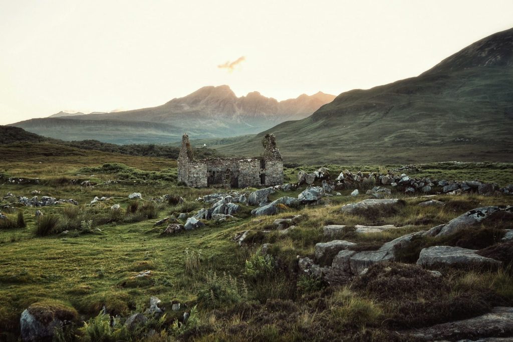
The Isle of Skye is defined by the Black Cuillin, a famous range made mainly of dark volcanic rock that gives it its blackish colour and jagged look, more reminiscent at first glance of the Dolomites than of Scotland. The highest point is Sgùrr Alasdair (992 m). As we have seen, the Inaccessible Pinnacle on Sgùrr Dearg is the only Munro that requires real rope climbing and therefore technical skills. Opposite, the Red Cuillin have rounder shapes and lower heights.
To discover Skye and the other island lands, explore our section on the Scottish islands.
Torridon and Assynt, the sandstone giants
In the north-west the landscape changes again. In Torridon rise Liathach, Beinn Eighe and Beinn Alligin, walls of red sandstone crowned with pale quartzite. Further north, in Assynt, the mountains stand alone above a plain of lochs and rock:
- Suilven, the “pillar” with its unmistakable profile. Unlike many other mountains, the challenge is not only the climb but also the long approach to its foot; the path winds a long way through moorland and bog;
- Stac Pollaidh is not very high (590 m) but quite steep; on a clear day the view is spectacular: thousands of lochs and lochans sparkling in the sun;
- Quinag and, a little further south, the wild ridge of An Teallach.
Schiehallion, the fairy mountain
In the middle of Scotland stands an almost perfect cone. Its name, according to tradition, means “fairy hill of the Caledonians”. In 1774 the astronomer Nevil Maskelyne used it for an experiment that made it possible to estimate the density of the Earth. It is one of those rare places where science and legend mingle.
Ben Lomond and Arran, the gateways to the south
- Ben Lomond (974 m) is the most southerly Munro and one of the most popular. It looks out over Loch Lomond and the Trossachs.
- Goatfell is the highest point on the Isle of Arran, known as “Scotland in miniature” for its mountainous land, stately castles and unspoilt beauty.
Legends and spirits of Scotland’s mountains
The Grey Man of Ben Macdui
Up in the Cairngorms lives the legend of Am Fear Liath Mòr, the Big Grey Man. It has struck the imagination of many hillwalkers, who have told of hearing heavy footsteps in the mist and feeling sudden terror. Those who claim to have seen him describe a being with human features but over three metres tall, sturdy and covered in short grey hair. In 1925 Professor Norman Collie, a respected scientist and mountaineer, said he had “heard” him and had been followed by someone as he came down from the summit. Whether a ghost or an optical illusion, the legend lives on.
The Cailleach, goddess of winter
In Gaelic folklore the Cailleach is the old goddess who shapes the mountains and brings winter. She is said to have created the hills by dropping rocks from her apron, and to watch over the deer of the Highlands. Many peaks still bear her name.
Practical tips for exploring Scotland’s peaks
When to go
- May and June are often the driest months, with very long days and few midges.
- July and August are warm (for Scotland), but it is also midge season; it is best to come prepared with a proper repellent.
- September and October bring splendid colours and the roaring of the stags. It is also deer-stalking season on many estates.
- In winter Scotland’s mountains become a serious alpine environment. You need crampons, an ice axe and experience.
Weather: rule number one
In Scotland the weather can change several times in a short while. Always checking mountain-specific forecasts (such as those from MWIS, the Mountain Weather Information Service) is the best approach.
The right of access
Thanks to the Land Reform (Scotland) Act 2003, Scotland has a broad right of responsible access to land, the so-called right to roam. You can walk and, following the rules, wild camp freely. The rules of conduct are set out in the Scottish Outdoor Access Code: leave no trace, and respect animals, crops and local activities.
Bothies: unstaffed shelters
Scattered through the most remote glens are bothies, simple free and unstaffed shelters, many of them maintained by the Mountain Bothies Association. They have no electricity or beds, and sometimes not even running water. Yet they can be an excellent refuge from the wind and from mist that rises without warning.
Scotland’s mountains are not conquered: they are crossed with respect and listened to, trying to understand what message they hold for us. Some say that whoever climbs them once is bound, sooner or later, to return.
Silvia Miraglia